LIDAR vs. Photogrammetry: What You Need To Know
The decision between LIDAR (Light Detection and Ranging) and photogrammetry can significantly impact the outcomes of various projects. In this article, we will explore the strengths, applications, and considerations of both technologies.
LIDAR vs Photogrammetry: The Basics
LIDAR and photogrammetry are key pillars in geospatial data capture and analysis. While LIDAR uses laser pulses to determine distances, crafting accurate 3D point clouds, photogrammetry capitalizes on images taken from varied angles. The latter stitches these images together, recreating the 3D structure of the subjects. Both methods have their strengths and applications, making it essential to grasp their distinctions to determine the most suitable approach for various tasks. We’ll dive deeper into these strengths below.
LIDAR vs Photogrammetry: In Comparison
Accuracy and Precision
When it comes to feature detection and overcoming limitations, often associated with passive sensors, LIDAR takes the lead. Its key advantage lies in its ability to detect a wide range of features, making it a preferred choice for tasks demanding superior versatility. Achieving sub-centimeter accuracy, LIDAR excels in applications requiring the utmost precision. This exceptional precision is attributed to the dense laser point coverage per unit area, allowing for intricate surface and detail representation. It finds valuable applications in various fields, including topographic mapping, building information modeling (BIM), and infrastructure assessment.
However, it's important to highlight that high-quality photogrammetry, too, delivers impressive results. In ideal conditions, both technologies can perform equally well, each with its unique strengths. LIDAR excels in collecting highly detailed depth information, while photogrammetry provides invaluable visual context of the environment, which is indispensable for many researchers. Factors like terrain type and atmospheric conditions can influence accuracy, but integrating LIDAR data with precise GPS coordinates and georeferencing further enhances its capabilities without diminishing the value of photogrammetry.
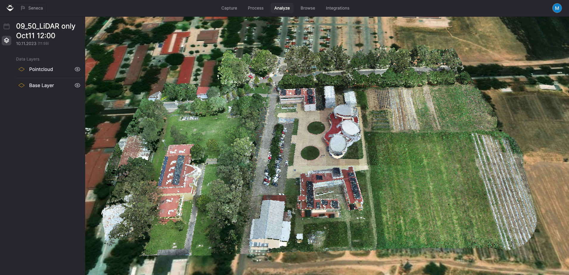 LIDAR excels in collecting highly detailed depth information.
Delve deeper into achieving pinpoint accuracy in geospatial data in the complete guide to mastering accuracy and precision in drone mapping.
Coverage and Efficiency
Both Photogrammetry and LiDAR offer unique advantages in geospatial data acquisition. Photogrammetry excels in terms of coverage and efficiency, as it can efficiently reconstruct highly detailed 3D models of expansive landscapes and complex architectural structures. Whether using aerial imagery from drones or ground-based photographs, photogrammetry is versatile and widely used for applications such as site evaluations, land-use planning, and ongoing environmental monitoring. It provides comprehensive insights into the physical world.
LiDAR, on the other hand, stands out with its ability to produce real-time point cloud visualizations, offering immediate insights into the environment. While LiDAR may require more time for post-processing and data analysis, its capability to generate accurate and precise 3D representations is invaluable. LiDAR's strengths lie in its ability to capture intricate surface details and detect a wide range of features, making it essential for tasks demanding superior versatility.
Ultimately, the choice between Photogrammetry and LiDAR depends on the specific needs of a project, with each technology offering distinct advantages that cater to different aspects of geospatial data collection and analysis.
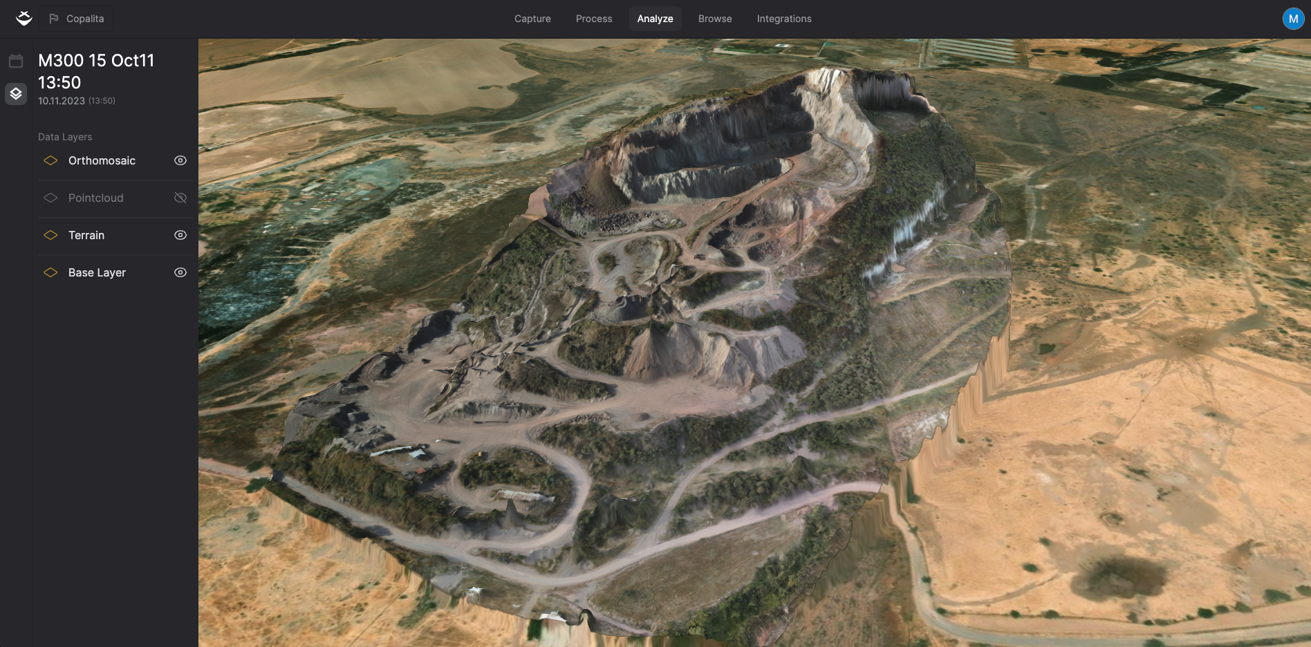 Photogrammetry excels in terms of coverage and efficiency.
Cost Considerations: Finding the Balance
LIDAR, with its intricate technology and exceptional accuracy, typically comes with a higher price tag. However, this higher cost can often be justified by the specific requirements of a project. For example, in scenarios where precision is paramount, such as urban infrastructure design or critical structural analysis, the investment in LIDAR technology can prove to be immensely valuable, as it can provide the necessary level of detail and accuracy.
Conversely, photogrammetry tends to be a more cost-effective option. Its affordability makes it an attractive choice for projects that prioritize extensive area coverage over the need for extremely fine-grained details. When budgets are limited or when the emphasis is on capturing large-scale terrain or landscape data, photogrammetry can strike a favorable balance between cost and utility.
In essence, it’s important to carefully evaluate the project requirements and financial constraints to determine which technology, whether LIDAR or photogrammetry, strikes the appropriate balance between precision and budget-friendliness, to achieve the desired outcomes effectively and efficiently.
Synergy in Integration
Considering LIDAR and photogrammetry as complementary rather than competing can yield significant benefits for engineering and geospatial projects. By integrating the precision of LIDAR with the rich visual information from photogrammetry, comprehensive datasets that align with multifaceted objectives can be created. This combination offers the best of both worlds, enhancing decision-making, enabling insights like terrain modeling and asset management, and improving data validation through cross-referencing, ultimately leading to peak results in diverse applications.
Conclusion
In the complex world of geospatial exploration and engineering, the LIDAR vs. photogrammetry debate doesn't center on one technology prevailing over the other. Instead, it's about harnessing the distinctive strengths of each technology to meet specific project requirements, precision needs, and budget considerations. By bridging the expertise of geoscientists with the pragmatism of engineers, we pave the way for innovative breakthroughs in our constantly evolving world.
Need more help? contact us for support