The Power of 3D Modeling with Drones
In the evolving landscape of geospatial tech, drones are helping to reshape our perception and analysis of our surroundings. Leading this revolution is 3D modeling, where drones merge aerial imagery, advanced software, and cutting-edge algorithms for intricate 3D representations. This article explores the dynamic world of drone-based 3D modeling, its advantages, and real-world applications.
The Essence of 3D Modeling with Drones
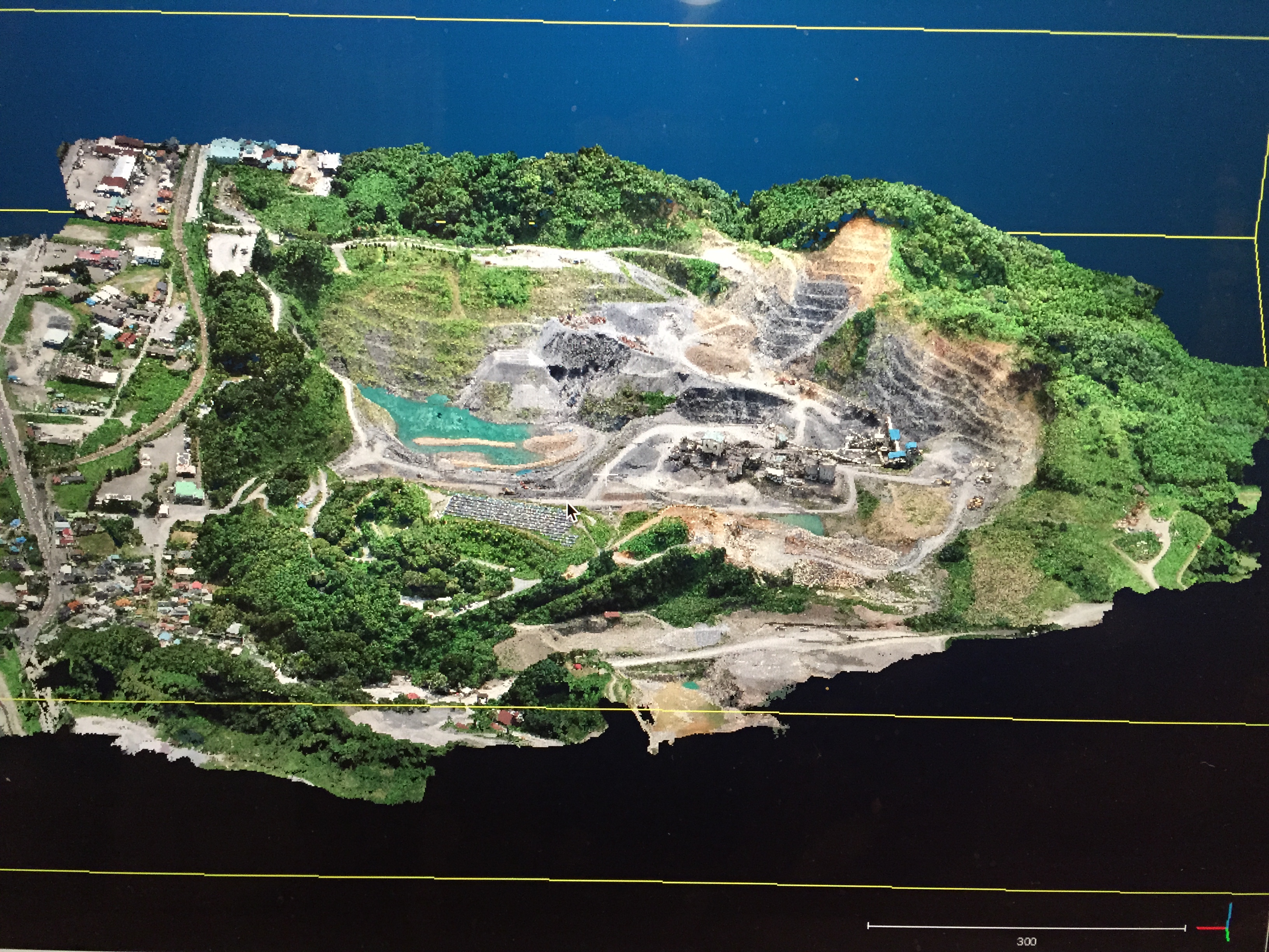
3D modeling with drones generates accurate and detailed three-dimensional representations of landscapes, structures, and objects using aerial imagery captured by unmanned aerial vehicles. Drones equipped with high-resolution cameras capture overlapping images from different angles and altitudes, forming the foundation of these models. Sophisticated software algorithms then stitch these images together, accurately reconstructing the spatial geometry and topography of the surveyed area.
Applications Across Diverse Domains
The applications of 3D modeling with drones are as diverse as the landscapes they capture. This technology has proved its worth in a variety of geospatial domains:
Urban Planning and Architecture:
In urban environments, 3D models aid in architectural visualization, urban design, and infrastructure planning. These models provide a tangible view of proposed developments and their impact on the surrounding area.
Environmental Management:
3D modeling is useful in environmental management, especially for ecological mapping and flood modeling. It offers precise elevation data for various assessments, including hydrology, and aids in predicting and managing floods. This assists and supports informed decisions for sustainable environmental management.
Cultural Heritage Preservation:
In cultural heritage, 3D models revive ancient artifacts and archaeological sites. They capture intricate details, facilitating restoration, documentation, and virtual exhibitions.
Civil Engineering and Construction:
3D modeling aids in site analysis, construction monitoring, and structural assessments. Engineers use these models to detect clashes and verify as-built structures.
The Process Overview
The journey to crafting an accurate 3D model using drones follows this process in short:
Data Capture:
Drones capture high-resolution images, often using grid flight patterns to ensure overlap. These images encompass the target area from multiple angles, capturing intricate details.
Photogrammetric Processing:
Specialized software employs photogrammetric algorithms to analyze and match key points in the overlapping images. These matches enable the software to reconstruct the 3D structure of the area.
Point Cloud Generation:
The software generates a point cloud—a collection of three-dimensional points representing the captured surfaces. This dense cloud serves as the foundation for the subsequent stages.
Surface Reconstruction:
Surface reconstruction algorithms transform the point cloud into a detailed 3D mesh, creating a digital representation of the terrain or object.
Texture Mapping:
The imagery captured by the drone is projected onto the 3D model, adding visual texture and enhancing realism.
Challenges and Innovations
Challenges and Innovations in 3D modeling with drones go hand in hand in the ever-evolving field of geospatial technology. While drones have revolutionized data acquisition, challenges like data processing efficiency, integration of multiple data sources, and ensuring precise georeferencing remain. However, ongoing innovations in machine learning, AI-assisted image analysis, and improved drone hardware are addressing these challenges head-on. These advancements are streamlining workflows, enhancing the accuracy of 3D models, and expanding the applications of drone-based 3D modeling across various industries, from construction to environmental management. As technology continues to evolve, so do the possibilities and solutions in the dynamic world of 3D modeling with drones.
In Summary
Adopting 3D modeling with drones catapults us into an era of unparalleled insight. The capacity to visualize, analyze, and engage with the world in three dimensions grants us a profound grasp of spatial relationships and patterns. Through the utilization of drones and state-of-the-art software, we open doors to a realm of possibilities, where 3D models serve as conduits for discovery, innovation, and well-informed decision-making.
Need more help? contact us for support