How to download your data with DroneMaps
How To Download Your Dataset
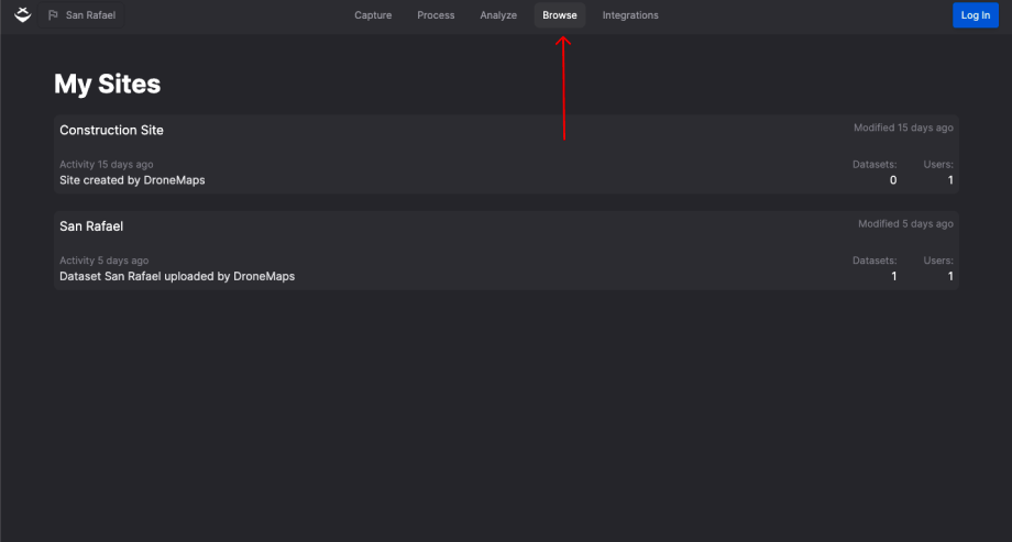
Step 1: Navigate to browse
- To begin the export process you must navigate to the browse tab
- Click on the browse tab at the top of the screen
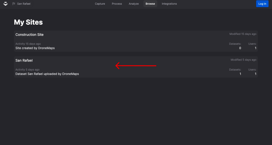
Step 2: Selecting the site
- To view the dataset you want to download the processed outputs from, begin by selecting the correct site.
- Then, click on that site to view the available datasets.
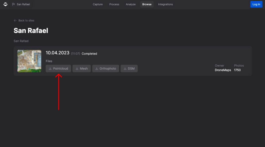
Step 3: Downloading the correct format
- After selecting your site, you'll find the datasets available for download.
- Select from various formats, such as raw photos, orthophotos, 3D Mesh, or point clouds.
- Click on the format that best suits your needs.
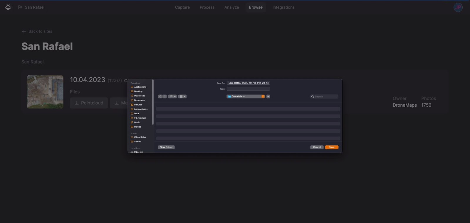
Step 4: Edit file name and start
- After selecting your desired output, take a moment to customize the file name for better organization.
- For example, if your dataset contains images of a construction site, consider naming it "ConstructionSite_Map_June2023" instead of using a generic or random file name.
- After editing the file name to your liking, click "Save" to confirm and initiate the download. This small effort in naming can greatly improve your data management.
Tips and Best Practices
Choose the Right Export Format
When downloading your data from DroneMaps, it's essential to select the appropriate export format based on your specific use case. DroneMaps offers various output options, including:
Raw Photos
- These are unprocessed images captured by your drone, providing you with the most detailed visual data. It's ideal for users who require unaltered imagery.
Orthophotos
- Orthophotos are georeferenced images that have been corrected for distortion, making them suitable for mapping and surveying applications. They offer highly accurate spatial information.
Point Clouds
- A point cloud represents the 3D surface of the area captured by your drone, offering the most reliable 3D data. It's beneficial for applications like 3D modeling and analytic calculations.
3D Mesh
- If you need a photorealistic representation of the point cloud data, 3D mesh files are the way to go. They consist of textured triangles and are suitable for visualizing the captured area in 3D computer graphics.
What's Next?
Now that you've organized your data and explored your datasets, it's time to dive deeper. To explore your processed dataset further, we recommend visualizing it on our platform. Here is what you can do:
Visualize in layers
Explore your dataset with different layers, each offering a unique perspective:
- 3D Mesh: Visualize your data in stunning 3D detail.
- Point Cloud: Dive into the precision of point cloud views.
- Orthophoto: view with high-resolution orthophotos.
- Base Map: Overlay your data on various base maps for added context.
Explore these features and learn how to visualize your geospatial outputs on DroneMaps
Need more help? contact us for support