The Role of Drone Mapping in Modern Agriculture
In this era of technological advancement, the fusion of drones and agriculture has forged a powerful synergy, redefining the landscape of farming and crop management. Drone mapping, an integral part of this partnership, has become a transformative force, offering farmers and agronomists unprecedented insights into their fields. In this article, we delve into the diverse applications of drone mapping in agriculture, exploring its benefits, economic impact, challenges, and the cutting-edge technology driving this revolution.
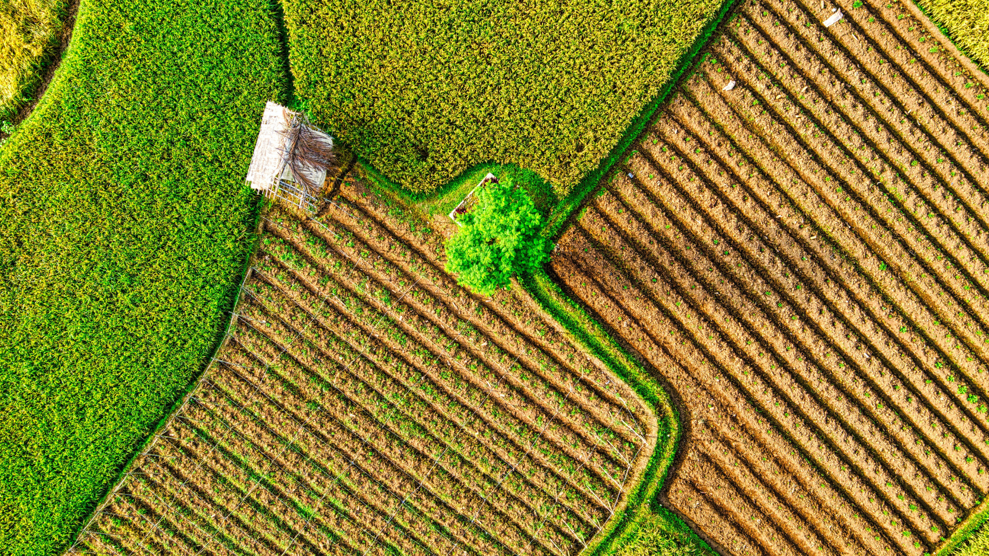
Mapping the Benefits
The integration of drone mapping in agriculture has yielded numerous advantages:
- Precision Crop Monitoring: Drone maps provide high-resolution images that enable farmers to monitor crop health, detect stress, and identify anomalies with unparalleled accuracy. These targeted insights facilitate early intervention and optimized resource allocation.
- Yield Estimation: Accurate yield prediction is crucial for planning harvest and logistics. Drone maps provide detailed crop counts and measurements, enabling farmers to make informed decisions about harvesting and distribution.
- Resource Management: By detecting variations in vegetation vigor and moisture levels, drone mapping assists in optimizing irrigation, fertilization, and pesticide application, minimizing waste and environmental impact.
- Field Mapping: Creating detailed maps of fields aids in land management, allowing farmers to delineate boundaries, track changes in land use, and plan infrastructure development.
Economic Gains and Sustainability
Using drone mapping in agriculture goes far beyond technology. It leads to real economic benefits and sustainable practices.
- Increased Productivity: Precise data from drone maps enhances yield prediction and resource allocation, ultimately leading to increased productivity and reduced input costs.
- Resource Efficiency: Targeted application of resources like water, fertilizers, and pesticides minimizes waste, lowering costs and minimizing environmental impact.
- Timely Intervention: Early detection of pests, diseases, or nutrient deficiencies enables timely intervention, reducing losses and enhancing crop quality.
- Risk Mitigation: Farmers can make informed decisions about crop diversification and insurance by assessing field conditions and predicting yield early on, mitigating risks associated with unpredictable weather and market fluctuations.
Navigating Challenges: From Technology to Adoption
While the benefits are promising, integrating drone mapping into agriculture has challenges. We’ve outlined some of these challenges below:
- Technology Accessibility: Drone technology and software can be costly, limiting access for smaller farms. However, advancements are driving costs down, making adoption more feasible.
- Regulatory Compliance: Navigating airspace regulations and obtaining necessary permits for drone flights can be complex, requiring adherence to local aviation authorities' guidelines.
- Data Interpretation: Extracting meaningful insights from drone-generated data demands agronomic expertise. Farmers and agronomists need training to effectively interpret and act on the gathered information.
- Privacy Concerns: Collecting aerial data may raise privacy concerns among neighboring properties or communities. Clear communication and adherence to ethical practices are essential.
Technology Powering the Transformation
Central to the use of drone mapping in agriculture are a range of cutting-edge technologies:
- Multispectral Imaging: Drones equipped with multispectral sensors capture images across various electromagnetic spectrum bands, revealing crop health indicators invisible to the naked eye.
- NDVI Analysis: The Normalized Difference Vegetation Index (NDVI) derived from drone maps quantifies plant health based on spectral reflectance patterns and guiding interventions.
- LiDAR Technology: Light Detection and Ranging (LiDAR) on drones capture 3D data, facilitating terrain modeling, canopy analysis, and volumetric measurements.
- Data Processing Software: Specialized software processes drone-generated data, creating orthomosaic and digital elevation models (DEMs) to facilitate data interpretation.
Conclusion: Harvesting the Future
Integrating drone mapping into agriculture welcomes a new era of precision and productivity. This symbiotic relationship between technology and the land cultivates economic gains, sustainable practices, and informed decision-making. As technology advances, costs decrease, and regulatory frameworks evolve, the potential for drone mapping in agriculture expands. By embracing this revolution, farmers and agronomists are sowing the seeds of innovation and reaping a bountiful harvest of progress.
Need more help? contact us for support