Drone Mapping for Construction: Enhancing Site Planning and Monitoring
The construction industry is no stranger to innovation, continually evolving to embrace technological advancements that enhance efficiency, precision, and safety. In recent years, the integration of drones and advanced mapping techniques into construction processes has ushered in a new era of site planning and monitoring. This combination of cutting-edge technology and traditional construction expertise offers substantial economic benefits, streamlining workflows, and elevating project outcomes.
The Impact of Drone Mapping in Construction
In the field of construction, precision is paramount. Accurate site measurements, timely progress assessments, and meticulous planning are essential for project success. This is where drone mapping steps in, bridging the gap between real-world construction needs and cutting-edge technology.
Drone Mapping Construction provides construction professionals with an invaluable tool for capturing highly detailed and up-to-date aerial imagery of their project sites. Equipped with high-resolution cameras and advanced sensors, drones offer a bird's-eye view that not only enhances site planning but also revolutionizes construction site monitoring.
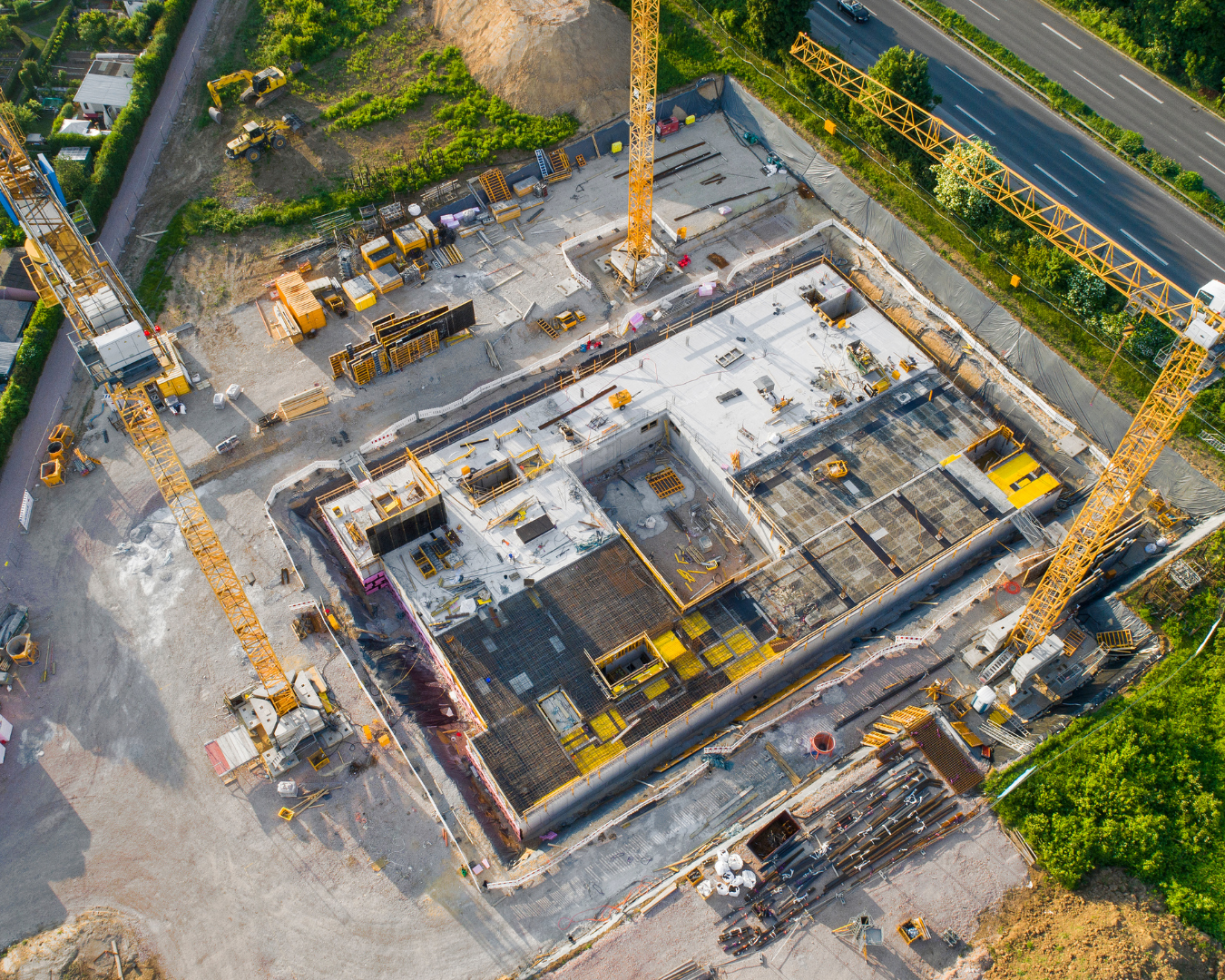
Construction Site Planning
Construction site planning has traditionally been a labor-intensive and time-consuming process. Surveyors and engineers have relied on ground-based measurements and manual data collection, which, while effective, often lacked the rapidity and comprehensive view that modern construction demands.
Construction Site Planning has been reimagined through drone mapping. Surveyors can now quickly and accurately capture site topography, existing infrastructure, and natural features from the air. These high-resolution aerial maps serve as the foundation for precise site planning, enabling architects and engineers to design with unmatched accuracy. From the earliest stages of a project, drone mapping sets the stage for success.
Construction Site Monitoring
Construction sites demand constant monitoring to ensure projects stay on track. Traditional site visits and manual inspections can be time-consuming and may not provide a comprehensive view of the construction site's progress.
Construction Site Monitoring, powered by drone mapping, transforms the way construction progress is tracked. Drones can fly over the site regularly, capturing updated imagery that can be compared to the original site plans. This real-time data enables project managers to identify potential issues, assess work quality, and ensure that the project stays on schedule.
Economic Benefits of Drone Mapping in Construction
Beyond the advantages of precision and real-time monitoring, drone mapping brings significant economic benefits to construction projects. By streamlining site planning and monitoring, construction professionals can save time and resources, ultimately leading to cost reductions.
The efficiency gained through drone mapping also has a positive impact on project timelines. Delays and errors can be identified early, preventing costly rework and disruptions. Moreover, accurate topographical data helps optimize construction workflows, reducing material waste and improving resource allocation. Swift surveys minimize field hours and surveying expenses with rapid drone data acquisition. These empowered decisions, driven by real-time insights, lead to fast, informed choices, effectively curbing project hold-ups. Additionally, detailed aerial data ensures the optimal utilization of machinery, materials, and manpower, contributing to resource optimization.
Constructing with Precision: Advantages for Builders
Utilizing drone technology in construction offers substantial benefits:
- Real-time Monitoring: Builders gain immediate project insights, allowing them to address issues as they arise, minimizing potential delays and costly rework.
- Informed Site Planning: Drone-generated 3D models provide valuable data for site planning, helping to avoid costly redesigns and optimize construction layouts.
- Quality Assurance: Regular drone oversight ensures that construction aligns with the original design plans, reducing the risk of expensive rework and ensuring the final product meets quality standards.
- Seamless Grading: Drone-forged digital elevation models (DEMs) empower accurate volume assessments, enabling builders to balance excavation with embankment seamlessly and refine grading tactics to curtail surplus earthmoving and consequent costs.
Overcoming Drone-Related Challenges
Drones bring immense promise to construction, but they also come with unique challenges:
- Navigating Regulations: Successfully deploying drones in construction projects involves complying with intricate aviation rules and obtaining the necessary flight permits.
- Big Data Management: The wealth of data collected by drones demands powerful processing tools and specialized software to effectively handle and analyze it.
- Georeferencing Mastery: Achieving precise georeferencing requires meticulous Ground Control Point (GCP) deployment and tuning, along with essential equipment like base stations for GCP measurements and implementing PPK or RTK workflows. High-quality base stations and GNSS receivers, albeit expensive, are often indispensable for accurate georeferencing.
The Future of Drone Mapping In Construction
As the construction industry continues to evolve, the integration of drone mapping has become a vital component of success. This technology-driven approach not only enhances the accuracy of site planning and monitoring but also contributes to cost savings and more efficient workflows.
The economic benefits, coupled with the collaborative revolution among construction professionals, are transforming the industry's landscape. Drone mapping has earned its place as an essential tool for those seeking to achieve excellence in construction site planning and monitoring.
In the fast-paced world of construction, staying ahead means embracing innovation. Drone mapping is not just enhancing construction; it's defining the future of the industry, one precise measurement at a time.
Need more help? contact us for support